Precision Below. Accuracy Above.
NULCA certified utility locating and subsurface mapping across Victoria and Western Australia. AS5488 compliant deliverables in CAD, GIS, and BIM formats.


Part of HR Surveyors — 70+ experienced surveyors backing every project.
Comprehensive precision utility mapping solutions and NULCA certified locating services for all your infrastructure projects.
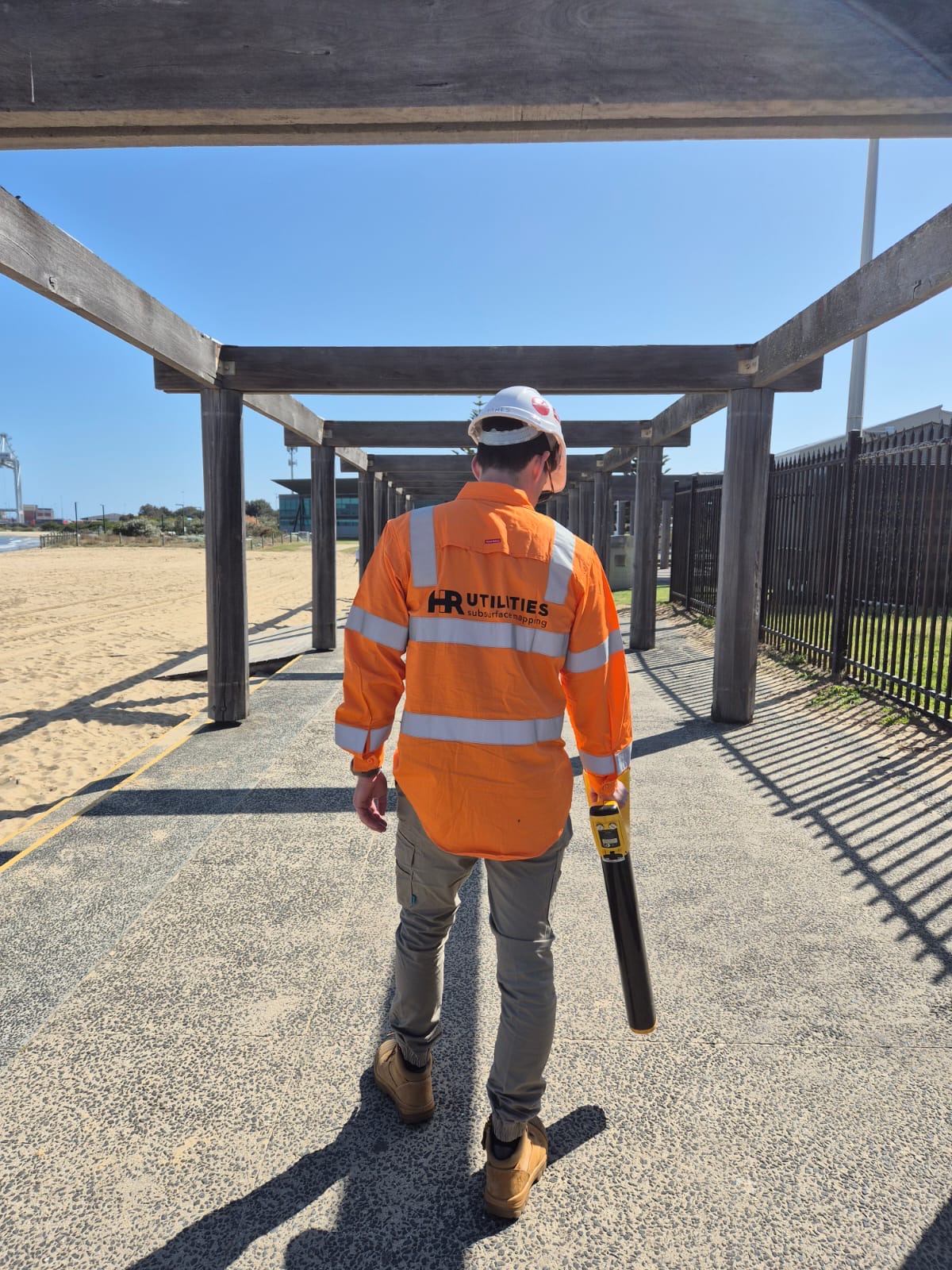
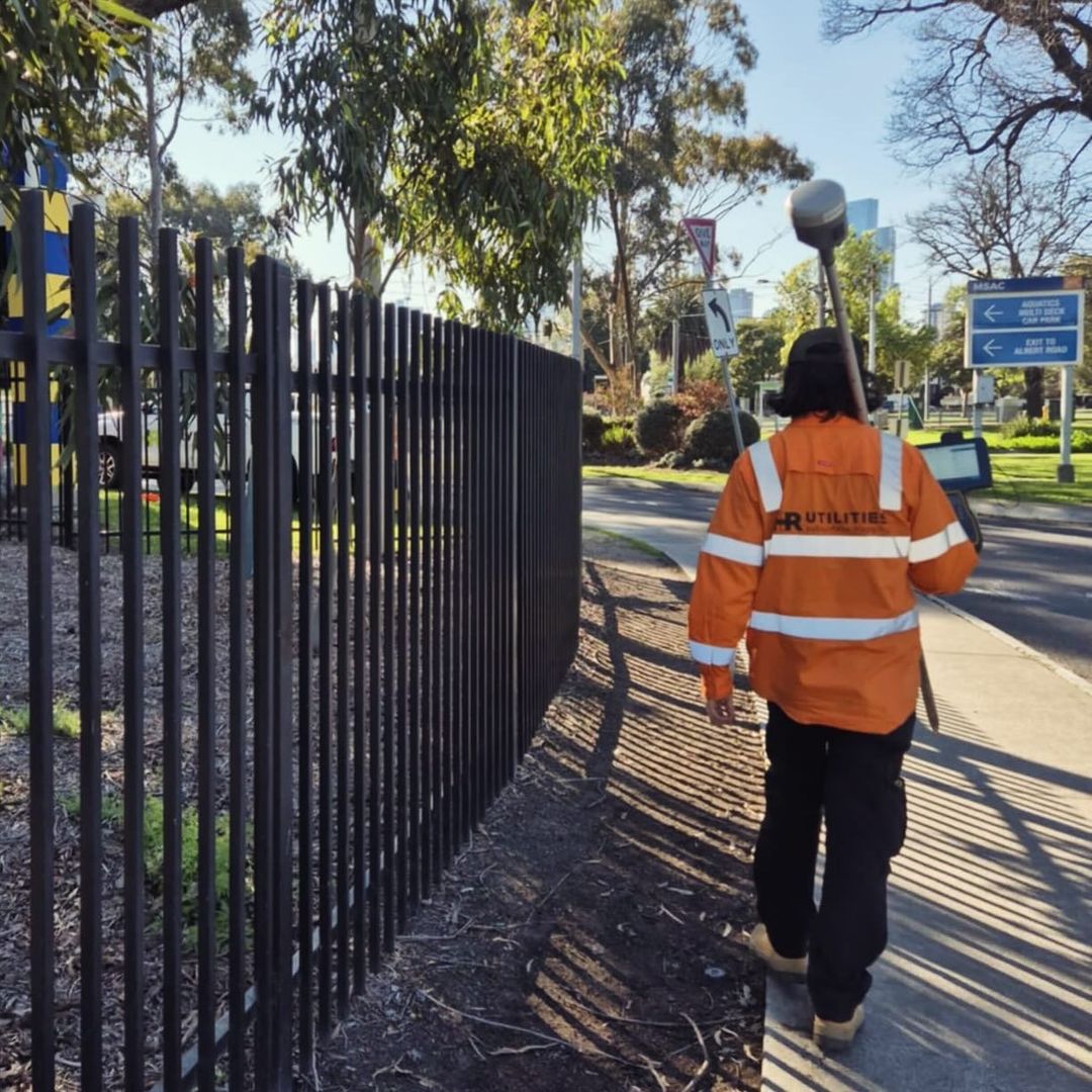
Our Utility Locating services use a combination of electromagnetic induction and Ground Penetrating Radar (GPR) to accurately locate both metallic and non-metallic underground utilities. By combining conductive, inductive, and passive locating techniques, we can quickly identify and trace utilities across large areas, even those with non-metallic lines using traceable copper rods. This approach ensures precise depth measurement without breaking ground, making it an efficient and non-invasive solution for your project needs.
Our Utility Locating services use a combination of electromagnetic induction and Ground Penetrating Radar (GPR) to accurately locate both metallic and non-metallic underground utilities. By combining conductive, inductive, and passive locating techniques, we can quickly identify and trace utilities across large areas, even those with non-metallic lines using traceable copper rods. This approach ensures precise depth measurement without breaking ground, making it an efficient and non-invasive solution for your project needs.
CCTV Inspections provide a clear, real-time view of underground pipes and drains, helping to quickly identify blockages, leaks, and structural issues. Using advanced camera technology, we ensure accurate diagnostics without the need for excavation, saving you time and money. Ideal for residential, commercial, and industrial projects.
CCTV Inspections provide a clear, real-time view of underground pipes and drains, helping to quickly identify blockages, leaks, and structural issues. Using advanced camera technology, we ensure accurate diagnostics without the need for excavation, saving you time and money. Ideal for residential, commercial, and industrial projects.
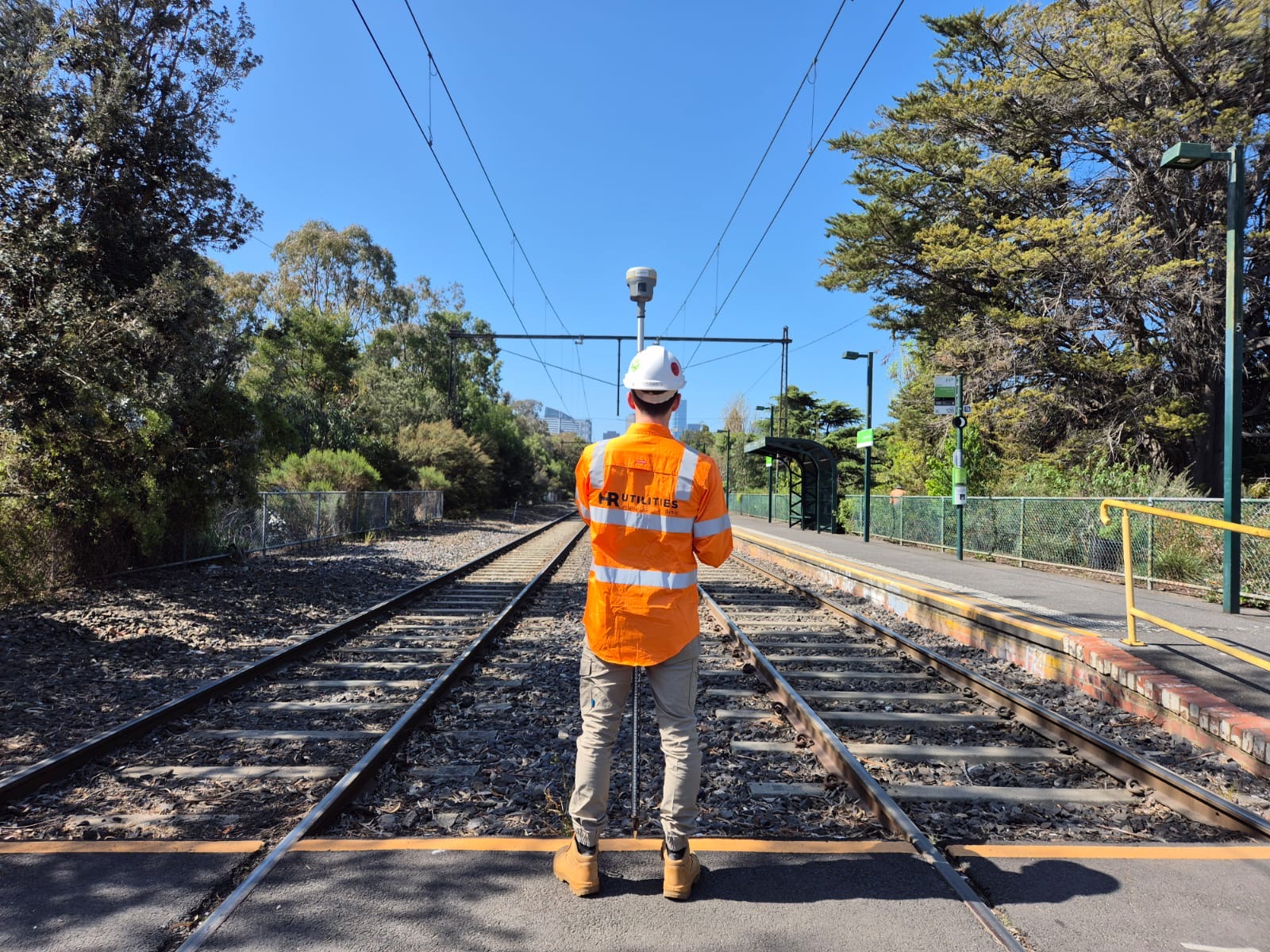
Our Utility Surveying team provide precise data collection, adhering to Australian Standard requirements. We ensure that all utility locations are accurately recorded and mapped to match any required datum, whether MGA or local. Our team delivers detailed survey plans that help you make informed decisions for your project, providing reliable and compliant documentation for safe and efficient construction or maintenance.
Our Utility Surveying team provide precise data collection, adhering to Australian Standard requirements. We ensure that all utility locations are accurately recorded and mapped to match any required datum, whether MGA or local. Our team delivers detailed survey plans that help you make informed decisions for your project, providing reliable and compliant documentation for safe and efficient construction or maintenance.
Concrete scanning uses ground penetrating radar technology to detect and map subsurface features within concrete slabs or structures. Various elements such as, voids or defects, utilities and reinforcement can be identified to help prevent accidents by revealing hidden hazards.
Concrete scanning uses ground penetrating radar technology to detect and map subsurface features within concrete slabs or structures. Various elements such as, voids or defects, utilities and reinforcement can be identified to help prevent accidents by revealing hidden hazards.
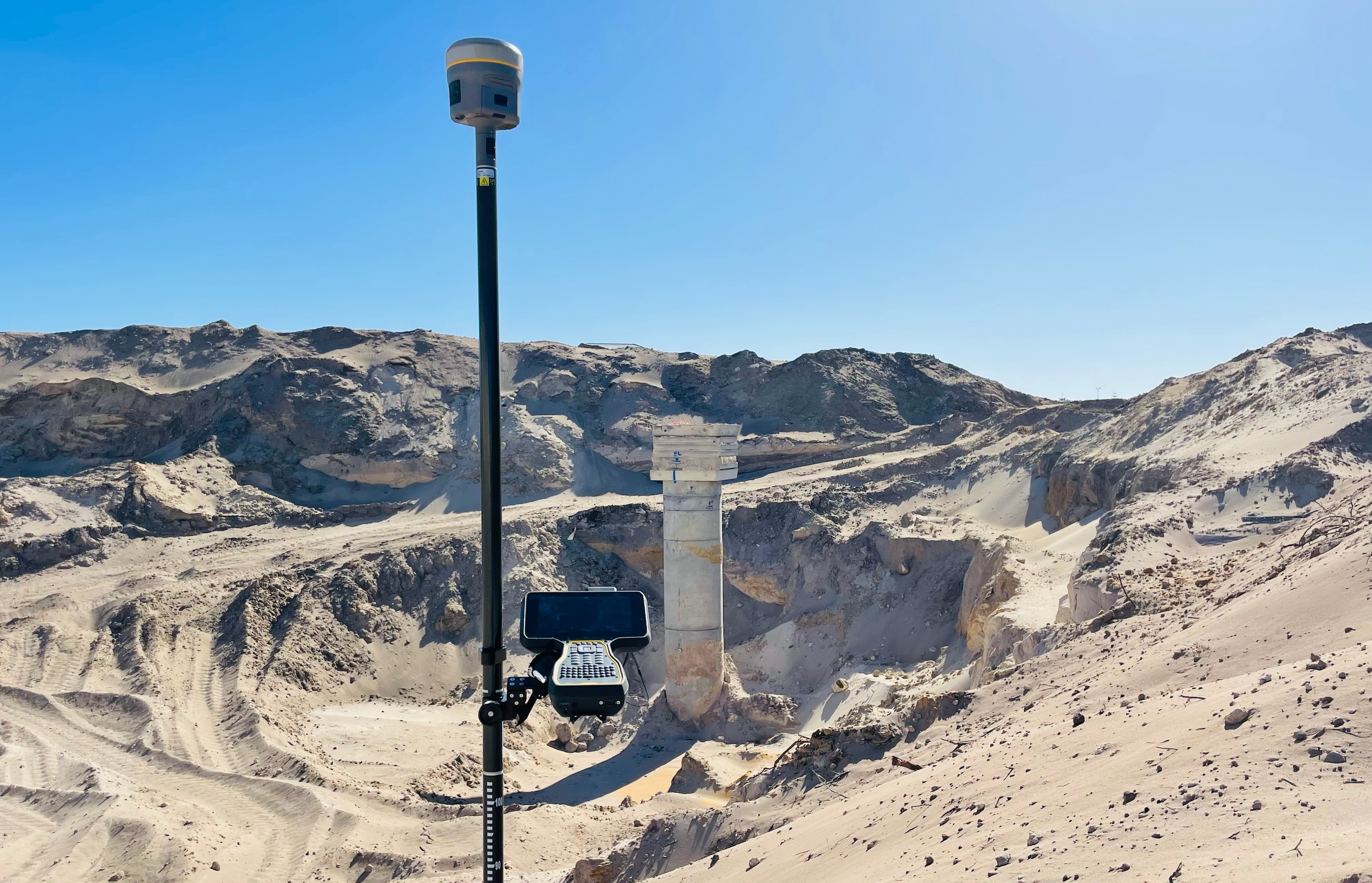
Our Feature & Level Surveys provide a detailed understanding of existing site conditions, forming a reliable foundation for planning and design. This service captures natural surface levels, existing built features, vegetation and above-ground utility assets using high-accuracy survey methods referenced to MGA and AHD. Feature & Level Surveys are essential for early-stage civil design, drainage planning, subdivision layouts, and redevelopment projects. All deliverables are provided in CAD and GIS formats, including feature plans, spot levels, contours, and digital terrain models to support efficient and informed decision-making.
Our Feature & Level Surveys provide a detailed understanding of existing site conditions, forming a reliable foundation for planning and design. This service captures natural surface levels, existing built features, vegetation and above-ground utility assets using high-accuracy survey methods referenced to MGA and AHD. Feature & Level Surveys are essential for early-stage civil design, drainage planning, subdivision layouts, and redevelopment projects. All deliverables are provided in CAD and GIS formats, including feature plans, spot levels, contours, and digital terrain models to support efficient and informed decision-making.
Our reports feature high-quality photographs, 4K 360-degree video, and detailed descriptions to provide an accurate baseline for all parties. This protects property owners, contractors, and developers from disputes or claims related to property damage. Suitable for residential, commercial, or large-scale projects, our dilapidation reports ensure all construction activities are well-documented and compliant.
Our reports feature high-quality photographs, 4K 360-degree video, and detailed descriptions to provide an accurate baseline for all parties. This protects property owners, contractors, and developers from disputes or claims related to property damage. Suitable for residential, commercial, or large-scale projects, our dilapidation reports ensure all construction activities are well-documented and compliant.
Our combination of UAV and handheld collection allows a complete site model to be built. Visualising the underground data against the above ground, is an efficient & effective visualisation tool for planning and design.
Our combination of UAV and handheld collection allows a complete site model to be built. Visualising the underground data against the above ground, is an efficient & effective visualisation tool for planning and design.
Capturing data in accordance with Australian Standard 5488 helps us translate and deliver the information you need. Whether you require a basic alignment with depth, overlay with PDF/CAD, up-to-date aerial base maps, 3D strings, IFC/BIM models, we can work with you to achieve the desired outcome for any project. Keeping your projects moving forward, with less redesigns and higher levels of safety.
Capturing data in accordance with Australian Standard 5488 helps us translate and deliver the information you need. Whether you require a basic alignment with depth, overlay with PDF/CAD, up-to-date aerial base maps, 3D strings, IFC/BIM models, we can work with you to achieve the desired outcome for any project. Keeping your projects moving forward, with less redesigns and higher levels of safety.
Non-destructive digging (NDD) uses pressurised water and vacuum excavation to safely expose underground utilities without mechanical risk. It is the method of choice for achieving QL-A quality-level verification of buried services near critical infrastructure.
Non-destructive digging (NDD) uses pressurised water and vacuum excavation to safely expose underground utilities without mechanical risk. It is the method of choice for achieving QL-A quality-level verification of buried services near critical infrastructure.
We locate and map stormwater drainage networks — pipes, pits, culverts, and headwalls — using GPR, EMI, and CCTV survey methods. Deliverables are georeferenced to MGA and AHD for direct use in civil drainage design and asset management.
We locate and map stormwater drainage networks — pipes, pits, culverts, and headwalls — using GPR, EMI, and CCTV survey methods. Deliverables are georeferenced to MGA and AHD for direct use in civil drainage design and asset management.
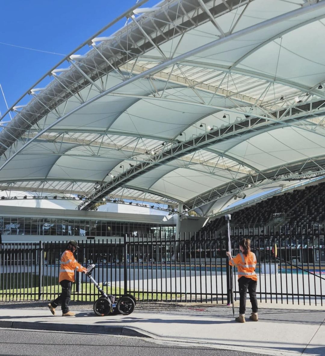
We use BYDA approved locating equipment, leveraging the use of drones, laser scanners, GPS & total station to capture and visualise site conditions, both above and below ground.
We use BYDA approved locating equipment, leveraging the use of drones, laser scanners, GPS & total station to capture and visualise site conditions, both above and below ground.
Having HR Utilities handle both locating and surveying means we don't need separate subcontractors. It saves us time, simplifies scheduling, and ensures a more accurate result from a single, cohesive team.
Senior Project Manager
Civil Infrastructure Contractor
HR Utilities provides detailed existing utility plans that no one else can match. Their comprehensive reports save us time and money by giving us clear, actionable data for every project.
Development Manager
Property Development Group
We've partnered with HR Utilities for a couple of years, and they always deliver reliable, accurate locating services. Their consistency and expertise make them a trusted part of our team.
Operations Engineer
Infrastructure Contractor
Common questions about utility locating, BYDA, and our services across Victoria and Western Australia.
Utility locating identifies the position and depth of buried services — power, gas, water, communications, and drainage — before any groundworks begin. It is required under Before You Dig Australia (BYDA) guidelines and Australian Standard AS5488 obligations before excavation, drilling, or any works that risk disturbing subsurface infrastructure.
Before You Dig Australia (BYDA) is the national referral service that notifies asset owners of your planned works and provides existing utility records for your site. Submitting a BYDA referral is a legal and contractual obligation before excavating in Victoria and across Australia. Our team aligns all locating work with BYDA response plans.
GPR typically detects utilities to 2–3 metres in favourable soil conditions. Detection depth and reliability vary by soil type, moisture content, pipe material, and site conditions. Where greater certainty is required, vacuum excavation (QL-A under AS5488) physically exposes and verifies services to confirmed depth and position.
We deliver CAD (.dwg), GIS (.shp), PDF plans, IFC/BIM models, and georeferenced data to MGA/AHD datums. For CCTV inspections, reports include HD video and condition documentation. All outputs are aligned to your project's design requirements. Contact our team to discuss your specific format needs.
Utility locating identifies where underground services are — their approximate horizontal position and depth. Utility surveying captures those positions in a spatially accurate, georeferenced coordinate system and produces a formal plan compliant with AS5488. As part of the HR Surveyors, our team can deliver both in a single, integrated workflow.
Yes. We work across residential, commercial, civil infrastructure, and government projects throughout Victoria and Western Australia. Whether it's a single-lot development or a major civil corridor, our team can scope the right level of service. Contact HR Utilities to discuss your project.
Contact the HR Utilities team directly with your project location, service type, and timeline. We will review your requirements and respond within 1 business day. Call us on 1300 533 612 or use the enquiry form on our contact page.
Technical articles for construction and civil engineering teams.
21 July 2026
Diggers booked, plans in hand, ground unmarked. What Melbourne teams should expect from field locating after BYDA: AS 54...
Read article 1 July 2026
Utility strikes cost Australia ~$4.6B every year. Understand why QL-D data leaves projects exposed, the AS5488 preventio...
Read article 18 June 2026
BYDA plans only go so far. Learn which underground services are public asset owner records, which are private, and what ...
Read articleView our recent precision utility locating and mapping projects across Australia
Expert utility locating services with BYDA certified precision.
Serving projects across Australia with advanced subsurface mapping solutions.