Professional feature and level surveys capturing existing site conditions — natural surface levels, built features, vegetation, and above-ground utilities — referenced to MGA and AHD. Trusted by developers, civil engineers, and architects across Victoria.
A feature and level survey provides a detailed understanding of existing site conditions before design work begins. It captures everything visible on site — ground levels, buildings, roads, vegetation, drainage structures, and above-ground utility assets — using high-accuracy survey methods.
All data is referenced to MGA (Map Grid of Australia) for horizontal position and AHD (Australian Height Datum) for vertical elevation. This means your design team receives survey data that integrates directly into their existing coordinate systems.
As part of the HR Surveyors with 70+ experienced surveyors, we deliver feature surveys that meet council DA requirements and provide the accuracy civil engineers need for detailed design.
Feature and level surveys are typically one of the first steps in any development project. They form the baseline dataset that every subsequent design decision is built on.
From single-lot residential redevelopment to multi-hectare greenfield subdivisions, an accurate feature survey ensures your design team starts with reliable, real-world data — not assumptions.
Four steps from site mobilisation to deliverables your design team can use.
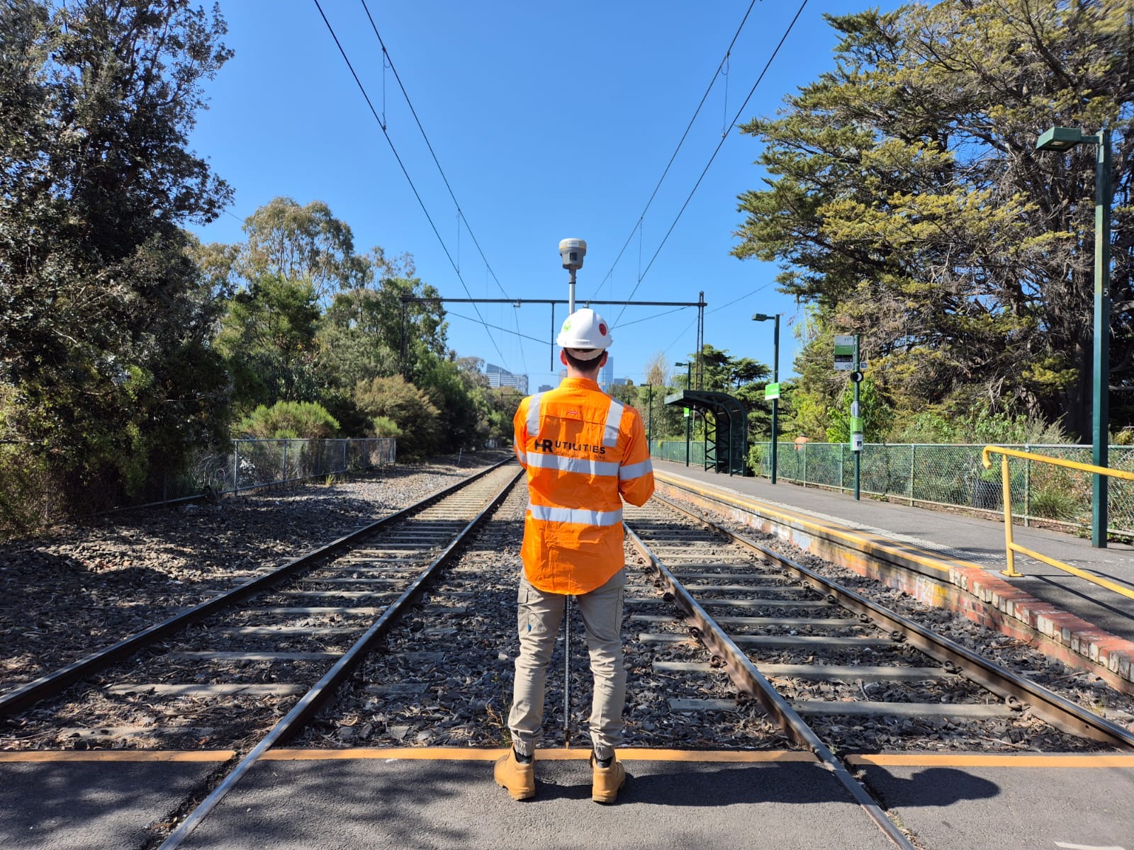
Our survey team visits your site with GPS, total station, and laser scanning equipment to begin data capture.
We record natural surface levels, existing buildings and structures, vegetation, above-ground utilities, roadways, footpaths, and other site features.
Field data is processed and referenced to MGA and AHD datums, producing a complete, accurate survey dataset.
You receive CAD feature plans, spot levels, contours, and a digital terrain model — ready for your design team.
Complete survey data ready for civil design, DA submission, and site planning.
Detailed 2D plans showing all captured site features with precise coordinates and levels.
Point elevation data and contour lines referenced to AHD, suitable for earthworks and drainage design.
3D surface model for use in civil design software, cut-and-fill calculations, and visualisation.
Feature-classified shapefiles and geodatabase exports for integration with broader project GIS.
Need a specific deliverable format? Contact the HR Utilities team to discuss your project requirements.
A feature and level survey is a detailed site survey that captures natural surface levels, existing built features, vegetation, and above-ground utility assets. All data is referenced to MGA (Map Grid of Australia) and AHD (Australian Height Datum) for use in civil design, drainage planning, subdivision layouts, and redevelopment projects.
Standard deliverables include CAD feature plans showing site topography, spot levels, contours, and a digital terrain model (DTM). All data is provided in CAD and GIS-compatible formats. Contact HR Utilities to discuss specific format requirements for your project.
Feature and level surveys are typically required before DA (Development Application) submission for civil design projects, drainage planning, subdivision layouts, building set-out, and redevelopment projects. Early engagement ensures design teams have accurate existing-condition data from day one.
Yes. HR Utilities operates from offices in Huntingdale (Melbourne) and Geelong, providing feature and level surveys across metropolitan Melbourne, Geelong, and broader Victoria. Our team of 70+ surveyors through HR Surveyors ensures rapid mobilisation.
Part of HR Surveyors — our surveying team has 70+ professionals delivering feature surveys across Victoria.
Expert utility locating services with BYDA certified precision.
Serving projects across Australia with advanced subsurface mapping solutions.