Experience the future of utility mapping with our advanced drone-mounted LiDAR systems. We deliver precise, three-dimensional infrastructure surveys for enhanced project planning and safety.
The integration of drones with LiDAR technology amplifies its advantages, particularly in urban environments where underground utilities are dense and complex.
Drone-mounted LiDAR systems can be deployed quickly, reducing project timelines and getting you faster results.
Drones can navigate challenging terrains or congested areas where traditional equipment might struggle, providing comprehensive coverage.
Faster data collection translates into reduced labor costs and project expenses, providing better value for your investment.
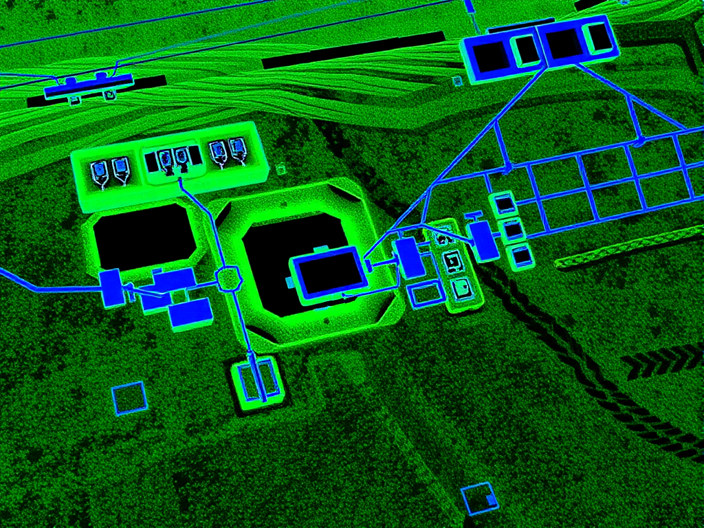
LiDAR provides detailed three-dimensional views of utility infrastructure, enabling better planning and decision-making.
We follow a comprehensive approach to ensure the highest quality results in all our LiDAR utility mapping projects.
Our cutting-edge LiDAR drones capture high-resolution spatial data from project sites, creating detailed three-dimensional maps of utility infrastructure.
Raw LiDAR data undergoes sophisticated processing to clean, align, and optimize the information for accurate utility mapping and analysis.
Processed data is seamlessly integrated with existing utility records and project plans, providing a complete visualization of underground infrastructure.
Learn more about how LiDAR technology is transforming utility infrastructure surveys in our detailed article on precision underground mapping with LiDAR technology. For underground utility work services, explore our underground utility work page.
Expert utility locating services with BYDA certified precision.
Serving projects across Australia with advanced subsurface mapping solutions.